How Directional Drilling Works in Brownsville Ground
The delta's last word, and the shore's first
Cameron County's ground tells the handoff story: inland, the Rio Grande's old delta — deep, rock-free clays and loams that drill smoothly under fluid chemistry tuned for sticky, reactive soil, in a climate whose wet-dry swings keep shallow ground on the move seasonally. Coastward, the section changes citizenship: barrier sands on the island, soft muds and tidal flats along the laguna, and saturated marine ground around the channel — buoyancy math, dewatered pits, and estuary-grade containment territory. The transition isn't subtle and neither is the pricing consequence: the quote names which ground your alignment lives in, because a clay number applied to the laguna shore is a schedule writing its own obituary.
Water with many managers
The county's water wears more uniforms than its land: the resacas with their managing utilities and drainage districts, the ship channel with port and navigation authority, the laguna with its estuary protections, the river's international system with IBWC jurisdiction and its levee-and-floodway works, and the county's drainage machinery threading it all. None of it is exotic once mapped, and mapping it is the local craft: our scoping asks the water question on every alignment, names the managers it finds, and schedules to their real clocks — including the launch corridor's, which answers to a calendar all its own.
The sequence, Lower Valley edition
The bones are standard — locates plus private designating, potholes on every claimed utility, pilot on profile, ream to about one and a half times the product, pull, restore. Lower Valley bends: fluid tuned by reach — clay chemistry inland, marine program at the shore; subtropical heat protocols through the long summer; hurricane-season staging discipline on the coast; closure-calendar coordination in the launch corridor; and restoration that treats resaca-front lawns, farm headlands, and island sand as the different surfaces they are.
Who owns what you're crossing
The cities — Brownsville, Harlingen, San Benito, Los Fresnos, Port Isabel — run their own ROW counters; Cameron County covers the roads between; TxDOT permits the expressway spine, the border highway, and the causeway approaches. The resacas' managing utilities and districts govern their waters; the port and navigation interests govern the channel; the estuary's protections govern the laguna; IBWC and the international system govern the river's edge; the bridges and the launch complex govern their own ground with federal-grade coordination. The quote names every owner on your alignment — in this county, start by asking which water is nearby.
Straight answers
Will you hit rock on my bore?
No — the delta didn't leave any at utility depth, and the island is sand all the way down its working section. The honest cautions are watery ones: sticky clay that wants tuned fluid, marine ground that wants buoyancy math, and a county where the second permit authority is usually a shoreline. The quote prices the real conditions.
How deep do bores run under Brownsville streets?
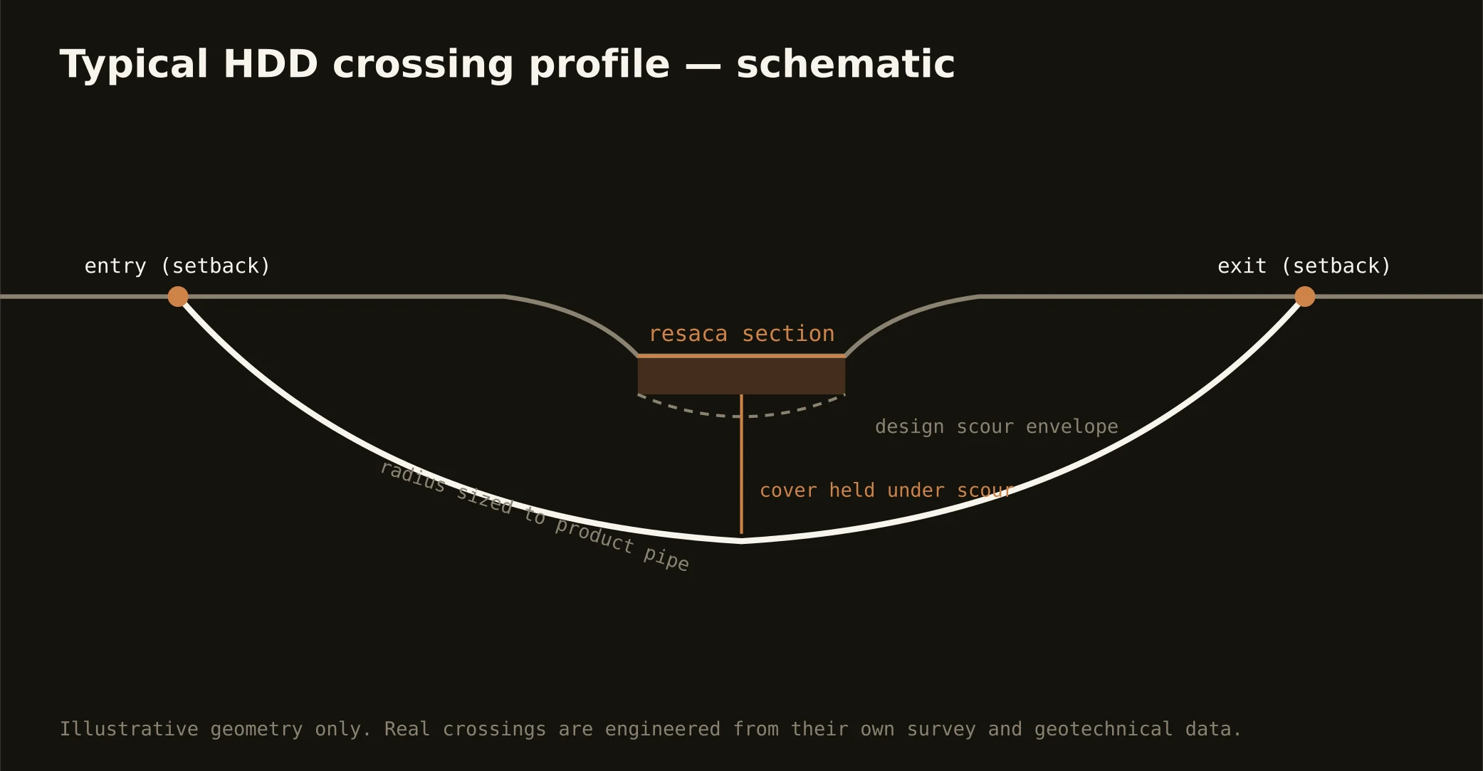
Cover follows the owning authority's standard and sits below everything potholed on the alignment — with resaca, channel, and laguna crossings running to the managing authority's criteria, and depths inland chosen with the clay's seasonal movement in mind. The bore plan states your number and your ground before mobilization.
Does the spaceport really change utility work here?
It changed the whole eastern county: an industrial corridor with launch-day closures, a port stacking LNG and steel construction beside it, and utility programs arriving at scales the Lower Valley never carried. For boring it means campus coordination, closure calendars, and marine-adjacent conditions in one scope — and a market where the network's engineering-forward quoting earns its keep weekly.
Ready to put a number on a real crossing? Send the scope — a person prices it.